List Page 1
This is the list of properties I have found…it’s a start, albeit a basic one. It’s taking a while to sort through them, add the links etc, but I’m also finding more to add..so it may take longer than I hoped. I’ll try and add about 50 per month and will keep each separate page to 100, so page 1 will be 1 – 100. I’ve done 31/3000 so only 2969 left to sort out. Watch this space
I’ve realised I’ve got copy protection on the entire site, so the list has been converted to a Word file which you can download, and copy the details from. There are also links embedded in that file. This table hasn’t copied correctly for some reason and looks a bit strange..I will hopefully correct that, but the links do actually work.
| 1 | Ruin | Colwyn Bay | North Wales | ||
| 53.276095, -3.756829 | Link | ||||
| 2 | Ruin | Abergele | North Wales | ||
| 53.242925, -3.671929 | Link | ||||
| 3 | Large ruin | Abergele | North Wales | ||
| 53.234797, -3.699707 | Link | ||||
| Large ruin, roof appears mostly intact | |||||
| 4 | Ruin | Abergele | North Wales | ||
| 53.229231, -3.679146 | Link | ||||
| 5 | Ruin | Abergele | North Wales | ||
| 53.229214, -3.667919 | Link | ||||
| 6 | Large cottage | Abergele | North Wales | ||
| 53.222159, -3.714610 | Link | ||||
| Large cottage, completely intact but appears out of use | |||||
| 7 | Ruins, | ||||
| 53.220951, -3.689169 | Link | ||||
| Ruins, probably barns, main building appears to have had a recent roof. GE 2015 shows all buildings neglected, partially roofed etc. | |||||
| 8 | Ruin | Abergele | North Wales | ||
| 53.222667, -3.674331 | Link | ||||
| Large ruin in what appears to be very good condition | |||||
| 9 | Ruin of house | ||||
| 53.224882, -3.637942 | Link | ||||
| Ruin of a 2 storey house, looks very intact | |||||
| 10 | Ruin on Farm | Abergele | North Wales | ||
| 53.223958, -3.611022 | Link | ||||
| Farm with all buildings intact and appear to be in good condition, but use as a farm clearly stopped, and may be out of use. A lovely set of buildings. | |||||
| 11 | Ruin | Churchstoke | Montgomery | ||
| 52.540720, -3.055635 | 17322523 | Link | |||
| See Full description and pictures below | |||||
| 12 | Trefenter | Ceredigion | |||
| 52.276208, -4.059627 | 15779799 | Link | |||
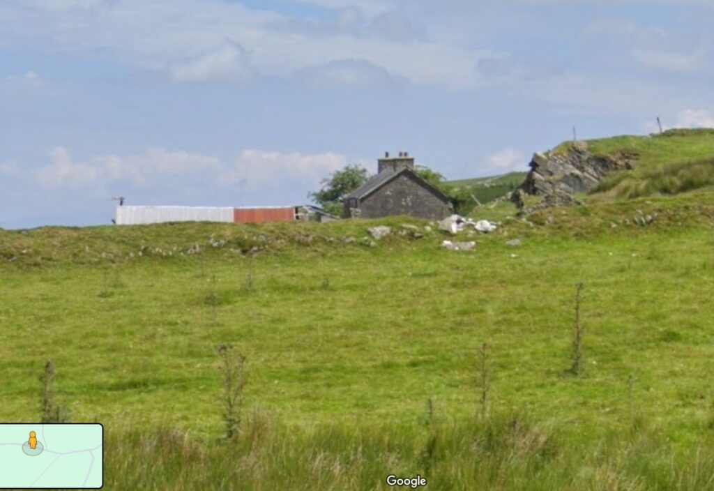
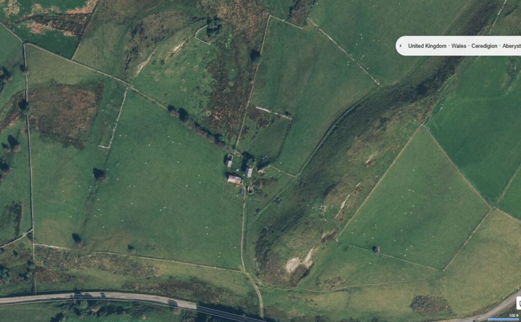
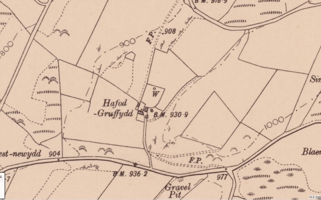
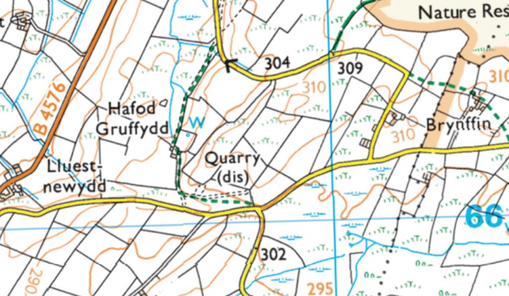
| Lluest Hafod Gruffydd, Bontnewydd, Aberystwyth (SY23 4JJ) No price Looks like a small farm which is almost completely intact, but clearly hasn’t been used for years. It is surrounded by a large block of land which, whilst still in uses, appears a little neglected. GE 2006 show track to farm is already overgrown. The buildings haven’t changed from the 1905 OS map showing that this is a farm that has never been updated with huge sheds as most are, and so remains in its traditional format. Quite rare. As a bonus, there is a footpath shown on the OS map so you can legitimately walk through this property, | |||||
| 13 | Complete farm | Pumpsaint | |||
| 52.096158, -3.919926 | 62646917 | Link | |||
| Fronfelen, Ffarmers, Llanwrda Appears to be complete but out of use farm VS £500K 2023 Includes a very large block of land around Also includes the cottage marked below Also has the large modern building set above the road above | |||||
| 14 | Large cottage and barn | Tregaron | Ceredigion | ||
| 52.257113, -3.879516 | 60138925 | Link | |||
| Ruin of a large cottage and adjacent barn with large block of land. No planning buildings appear to be very intact and next to a decent hard track. Right on the edge of the mountains. VS £5K, 2019 The land use has not changed since that date. A very restorable couple of buildings with land in an isolated location. | |||||
| 15 | Intact cottage | ||||
| 52.260449, -3.873972 | NR | Link | |||
| Cottage with an adjacent block of land. Appears out of use, but has roof on. Land is used by farmer. Strange division of land with adjacent (registered title) 15727208 VS under £100K 2021 Hafod Rhyd, Pontrhydfendigaid, Ystrad Meurig (SY25 6EL) this is part of the adjacent farm. No planning, but shown on the map as intact Shown on 1905 Castell Fflur FP close to, but not through land | |||||
| 16 | Converted school | ||||
| 52.263918, -3.886183 | 54052964 | Link | |||
| Looks like a bungalow from the side of the road, looks well neglected, last use 2010 approx. Only has small plot of land with it Pen Y Garn, Pontrhydfendigaid, Ystrad Meurig. No price There is also a small stone building right next to but below the road Shown as a Sunday school on 1905 OS along with the 2nd building Lead mines in field opposite.Name Pen Y Garn No Planning | |||||
| 17 | Complete farm | ||||
| 52.294594, -3.916201 | 57358732 | Link | |||
| Farm, complete, all buildings including the house are intact, but little evidence of recent use Llwynmalus, Tynygraig, Ystrad Meurig (SY25 6AJ) VS £500K, 2015 so probably includes more titles. The land is actively farmed. FP goes through from the road | |||||
| 18 | cottage | Lledrod | Ceredigion | ||
| 52.321047, -3.980622 | 15682596 | Link | |||
| Looks like an intact but unused cottage in the middle of a large block of land Land and buildings on the east and west side of Moelwyn, Lledrod, Aberystwyth Sold £238K 2009 The farm itself has no price but is registered 15664740 and looks historically neglected, but now some activity There is a track to the property through the farm, appears intact but no FP access | |||||
| 19 | cottage | Llanafan | Ceredigion | ||
| 52.357746, -3.956814 | Link | ||||
| Cottage or barn, appears intact on GE a few years ago. Hard to tell now. Shown on OS maps | |||||
| 20 | Cottage and barn | Trawscoed | Ceredigion | ||
| 52.355315, -3.964298 | 15195428 | Link | |||
| Sits in the middle of a large block of land with strange squared off boundaries Appears to be in the middle of afields No evidence of use, but mostly intact Blaencynon, Llanfihangel-y-Creuddyn, Aberystwyth, (SY23 4LG) VS £282 2016 | |||||
| 21 | Cottage, ruin | Abermagwr | Ceredigion | ||
| 52.360432, -3.967986 | Unknown | Link | |||
| Appears to be the intact shell of a cottage, sits in the middle of well used fields. Haven’t investigated further | |||||
| 22 | Cottage with woodland | Llanilar | Ceredigion | ||
| 52.365001, -3.985286 | 60105428 | Link | |||
| Appears to be a cottage with a block of woodland, possible 1- 1.5 acres in total. Looks intact, but not in use. Access from a track Dolypandy, New Cross, Llangihangel-Y-Creuddyn, no price Bridal path goes past | |||||
| 23 | 2 long barns | Llanfarian | Ceredigion | ||
| 52.366221, -4.073722 | 58341139 | Link | |||
| Probably a cottage with a long barn. One of the buildings has most of its roof intact, the other is a shell, but intact. Aberbrwynen fach No planning Not on FP but FP does go through the farm, and then there is a lane to the property VS £1.7M in 2016. This appears to be part of the farm, but there is no map available | |||||
| 24 | |||||
| 52.234614, -4.237735 | 15282753 | Link | |||
| Lletty Crochan, Llandewi, Aberarth no price 15283320 | |||||
| 25 | |||||
| 52.231962, -4.225922 | 15315137 | Link | |||
| Cefnwig, Aberaeron (SA46 0EG) Shell of cottage with land no price No planning Has about 5 acres with, all appears to be in use 15308021 different title, but is the large farm to the left. Has the same details | |||||
| 26 | Farm with buildings | Talybont | Ceredigion | ||
| 52.498778, -3.975879 | 14836471 | Link | |||
| Cefnerglodd, Llancynfelyn, Machynlleth no price Farm, main house appears intact but out of use. Title has a large block of surrounding land. Land is in use. Has FP’s going through | |||||
| 27 | Farm, house a ruin | Talybont | Ceredigion | ||
| 52.494812, -3.973690 | 57800991 | LOink | |||
| Pen Y Banc, Talybont (SY24 5HJ) What looks like the farm house can just be seen on old Google Earth images. Has very large block of land and possibly a second range of buildings which are shown on the 1905 OS FP goes past | |||||
| 28 | Cottage, ruin | Furnace | Powys | ||
| 52.531065, -3.932869 | 15695427 | Link | |||
| Cottage on edge of woods with land around. Shell looks intact Land adjoining Tynygarth, Machynlleth This title includes a huge block of woodland to R of property, but not the nearest two fields | |||||
| 29 | Industrial buildings | Furnace | Powys | ||
| 52.522657, -3.942927 | N/A | Link | |||
| The remains of an old mining complex which appears to include the complete shell of a large house. This sits in the middle of a huge block of land which includes a number of old cottages, most of which have been preserved with Tin roofs. None of this is registered. The land wraps itself around a farm complex called Cefngweiriog which is actively used. Whoever owns this property has taken steps tp protect all of the buildings and kept them complete and therefore fully restorable. Farm looks in very clean condition and well used. Road goes right through the middle of the farm and the entire block of land. Many of the buildings can be seen on SV | |||||
| 30 | Chapel | ||||
| 52.501343, -3.960468 | 46396180 | Link | |||
| Land at Pensarn, Talybont (SY24 5HJ) Intact chapel sitting on what is now the edge of a modern farm complex VS £40K 2017 15237751 Farm However the farm is listed as Pensarn, Talybont (SY24 5HJ) VS £800K with the same date, so clearly the same ownership This is however listed as the building only, no land at all around it!! | |||||
| 31 | Large intact ruin | Furnace | Powys | ||
| 52.499502, -3.947202 | N/A | Link | |||
| Looks like the ruin of a large farm house, wall are very intact and there is a nearby building with a tin roof on it. Not listed on LR but probably part of the very large block of unregistered land that surrounds it. Very isolated location on the edge of wild hills | |||||
This is Property 11 on the above list. I’ve put info on property 12 below this. An intact farm in Ceredigion ripe to be developed.
This is the way I document the information I find when I do more than just see the location of a property.
It probably took me 15 minutes to look at all the various view that are available online. I don’t normally copy the pictures, but they show you what is available to be found.
With every list I shall probably put at least one property on with as much info as possible. If I have the information, you may as well have it.
27/006
52.540720, -3.055635
17322523
Ruin that has part of the roof remaining
LR states “land adjoining Todleth House, Montgomery”
Sits in what appears to be a few acres, no price
Appears to be the same as all the surrounding land and has access routes going through
Divisions between it and neighbours appear to be diminishing
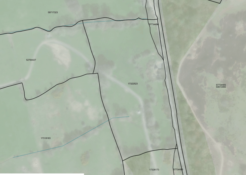
Details of adjacent blocks of land
52764427
Land on the north east side of The View, Church Stoke, Montgomery (SY15 6DT) No price
Note this land extends to the edge of the village and includes the farm which appears to be making use of all the land of which this is part, despite there being a number of different titles. Note the track that runs from the farm through all of the land
17318183
land and buildings at Church Stoke No price
17328173
Land adjoining Todleth House, Churchstoke No price
59717323
Land at Todleth Farm, Old Church Stoke, Montgomery
VS £129K 2013 (VS is is value stated, i.e. inherited, not sold)
For planning appears to be part of Powys
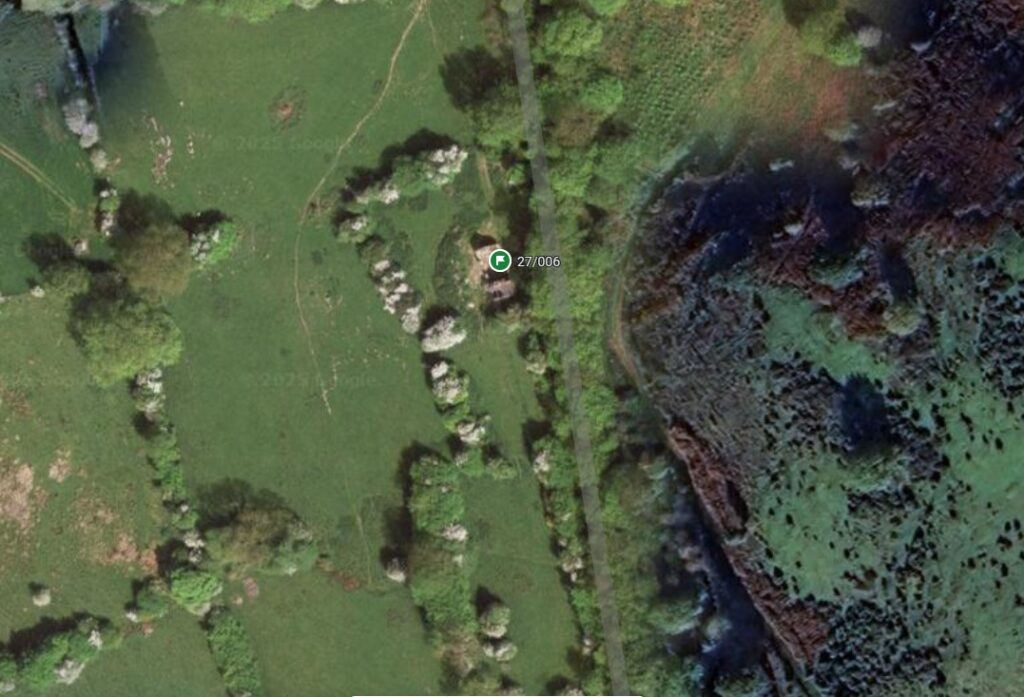
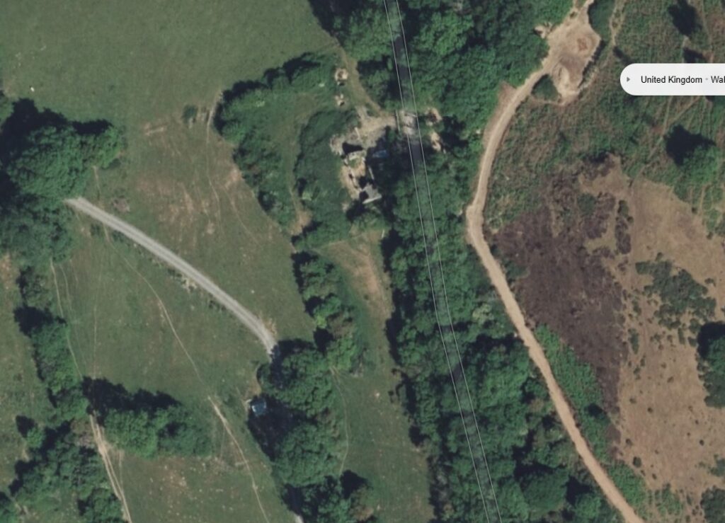
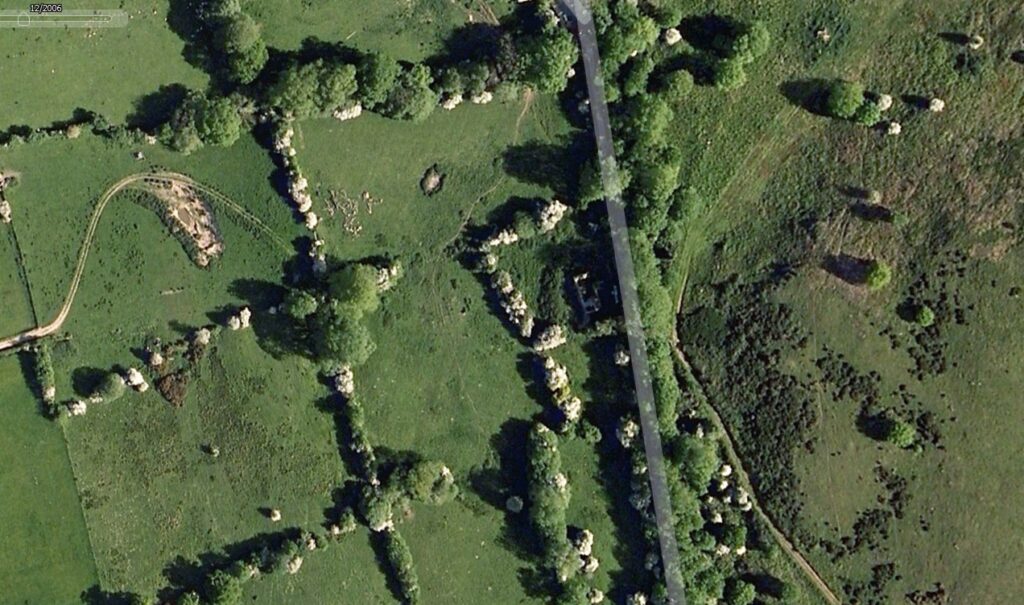
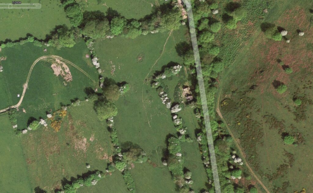
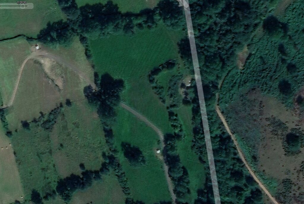
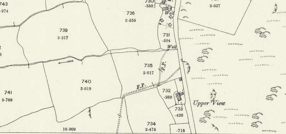
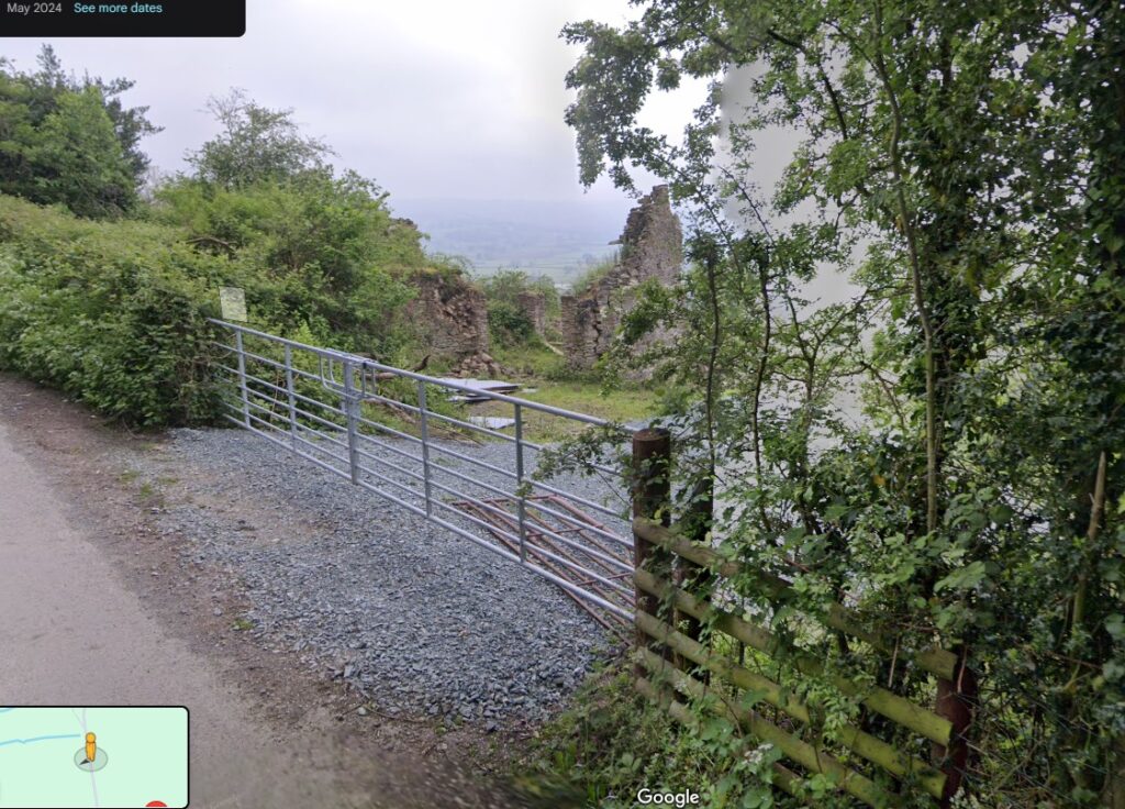
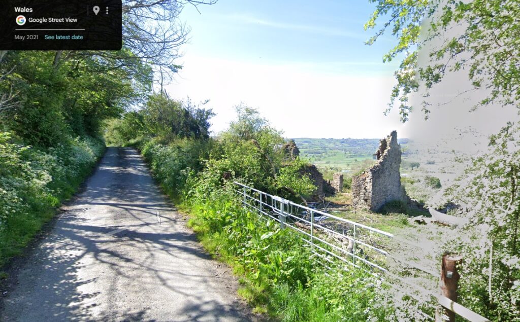
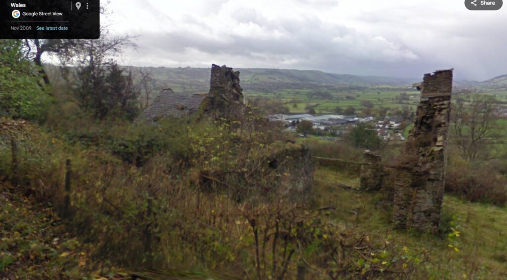
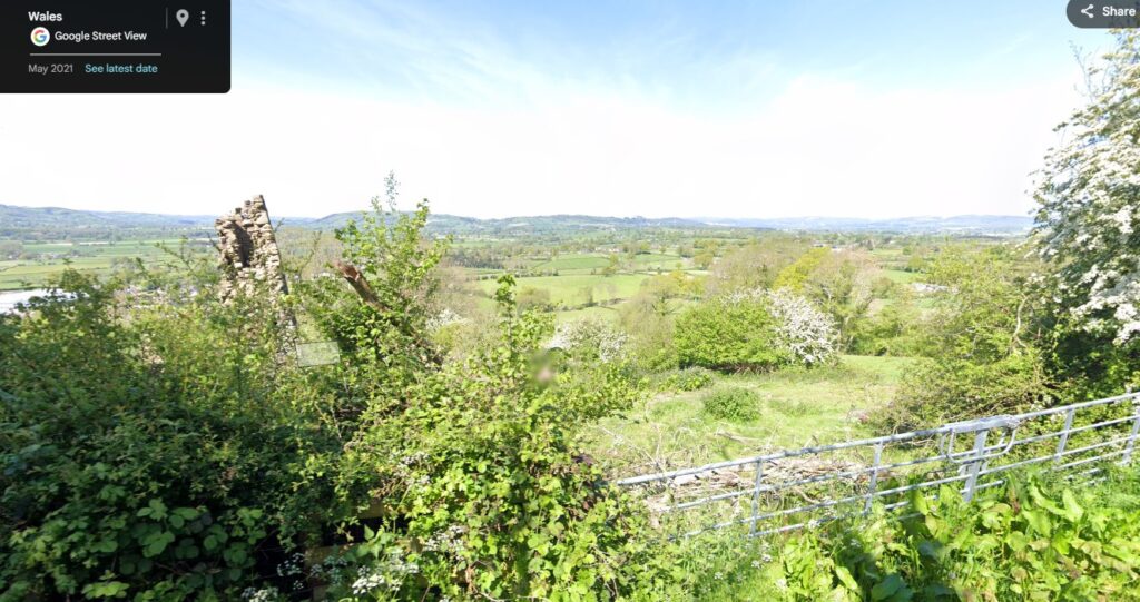
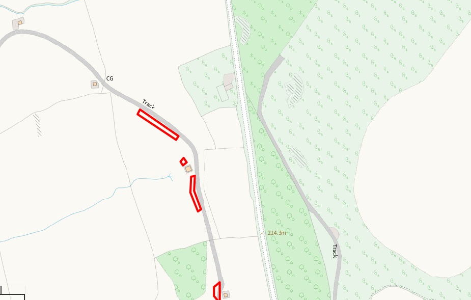
This is quite a ruinous property with what appears to be the majority of both the Gable ends intact, however there is a small extension at the far end of the property which actually retains its roof.
Believe it or not this may have a huge bearing on whether the property can gain planning permission to be redeveloped.
Having a roof on part of the property indicates that it is not an incredibly long time since it was intact and in use so this may be an important factor.
The property is clearly shown on the 1905 map and appears to be quite a large building. It’s almost immediately adjacent to a good road, and you can see the entrance has clearly been rebuilt in recent times. The double gates you can see can be seen on historic street view photographs, but the most recent of these shows a track driving up to the road presumably so the rest of the land is accessible. This is also a matter for concern as farmers have an incredible tendency to see a building like this as a pile of rocks which they can simply smash down and use as hardcore. If this is done then the chances of getting planning diminishes dramatically.
A ruin in whatever condition always stands of vastly better chance of being redeveloped than if it has been completely swept away.
And this does happen quite frequently. Another property I looked at to add to this list had what looked like the original farmhouse. However this was abandoned and unroofed but was sitting on the edge of the remains of the farm which clearly continues to be used
That Ruin has now been swept away and there’s no indication of what is going to be built there.
I suspect a large steel frame shed will materialize at some point.
As I have pointed out before I believe farmers have very little sense of the potential value of even ruins on their property and simply see these as an inconvenience.
Oh, and the spectacular view. I can see it, so can you. The person who owns this is probably so used to it, they barely register it as being special.
So what can you do with this kind of stand pile of stones? Well councils in Wales are increasingly giving permission for the ruins of properties to be redeveloped. I have seen others with way less remaining than this getting planning to redevelop what in effect becomes a brand new house in a spectacular location sitting on a couple of acres.
In terms of ownership this Ruin actually sits on what appears to be a block of a couple of acres but as can be seen with the information I gathered the surrounding blocks of land all have the same characteristics and all appear to lead back to the same farm down in the village which suggests that they’re all in the same ownership. The fact that it is registered means that you can find out who the owner is and approach them if you want to. This is not property for adverse possession; it has an owner, and the land that surrounds it is clearly in use. However if you have resources and potentially deep pockets this could be spectacular location to build very interesting property
Property 12 on the List. A very recent find.
Lluest Hafod Gruffydd, Bontnewydd, Aberystwyth (SY23 4JJ)
No price
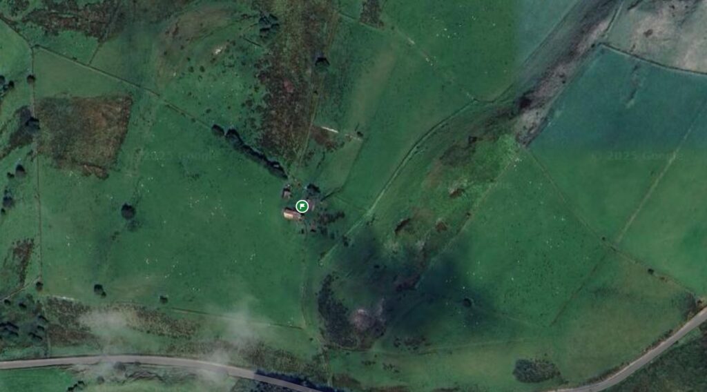
Looks like a small farm which is almost completely intact, but clearly hasn’t been used for years. It is surrounded by a large block of land which, whilst still in uses, appears a little neglected. GE 2006 show track to farm is already overgrown.
The buildings haven’t changed from the 1905 OS map showing that this is a farm that has never been updated with huge sheds as most are, and so remains in its traditional format. Quite rare. As a bonus, there is a footpath shown on the OS map so you can legitimately walk through this property,
Disclaimer
Every single property that I will be listing has been found by searching online mapping Google Maps, Google Earth and bing maps. Over the years I have visited as many properties as I can and have taken photographs etc but I have also frequently discovered that what appears to be abandoned does actually have signs of activity when you get there. Some of these properties do have signs of activity but still appear to be neglected or completely abandoned and will still be included on this list as then maybe people out there who wish to find them seek out and Owner etc and trying to buy them. the disclaimer is that I can make no guarantee that any property that I’m listing here is actually abandoned, only that there are certain signs that they appear to be. In every single instance anybody who has an interest in any of these properties has to make their own inquiries, has to make a visit to the property themselves to satisfy themselves of its condition and has to be respectful of what may well be existing owners, and people still living in some of these properties. Please tread carefully…